
Aerial Services
- Aerial Photogrammetry
- Aerial Infrared Remote Sensing
- Aerial Videography
- Contour Generation
- Volume & Area Calculations
- Three Dimensional Rendering
- Planimetrics & Feature Delineations
- Geologic Mapping On Contact Exposures
Mapping Services
- Land Site Development
- Viewshed Analysis
- Orthophoto Overlays
- Time Series of Historic Photos
- Historical Mine Map Overlay & Interpretation
- Watershed Analysis
- Groundwater Mapping
- Subsurface Geologic Modeling
Rendered 3D Quarry Model

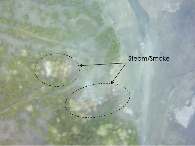
Low Resolution Color Aerial Image
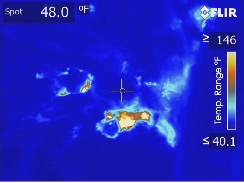
Thermal Aerial Image
Quarry Overview
Landfill Revegetation